When we stop to see things as we travel, many times we are met with much more than the beauty we experience at first glance. The history and even the stories of the beautiful landscape make our visit an adventure to remember! Independence Rock is part of our American Heritage! Recognizing actual sir names of people whose names I see inscribed in this granite rock, and further discovering that there is a story about a pioneer from the State of Indiana who went above and beyond to preserve the Oregon Trail made this an incredible adventure. Continue reading to see what I mean...
Just a reminder as you view the photos, you can click on any one of them to enlarge it and "x" out of it to return to the blog.
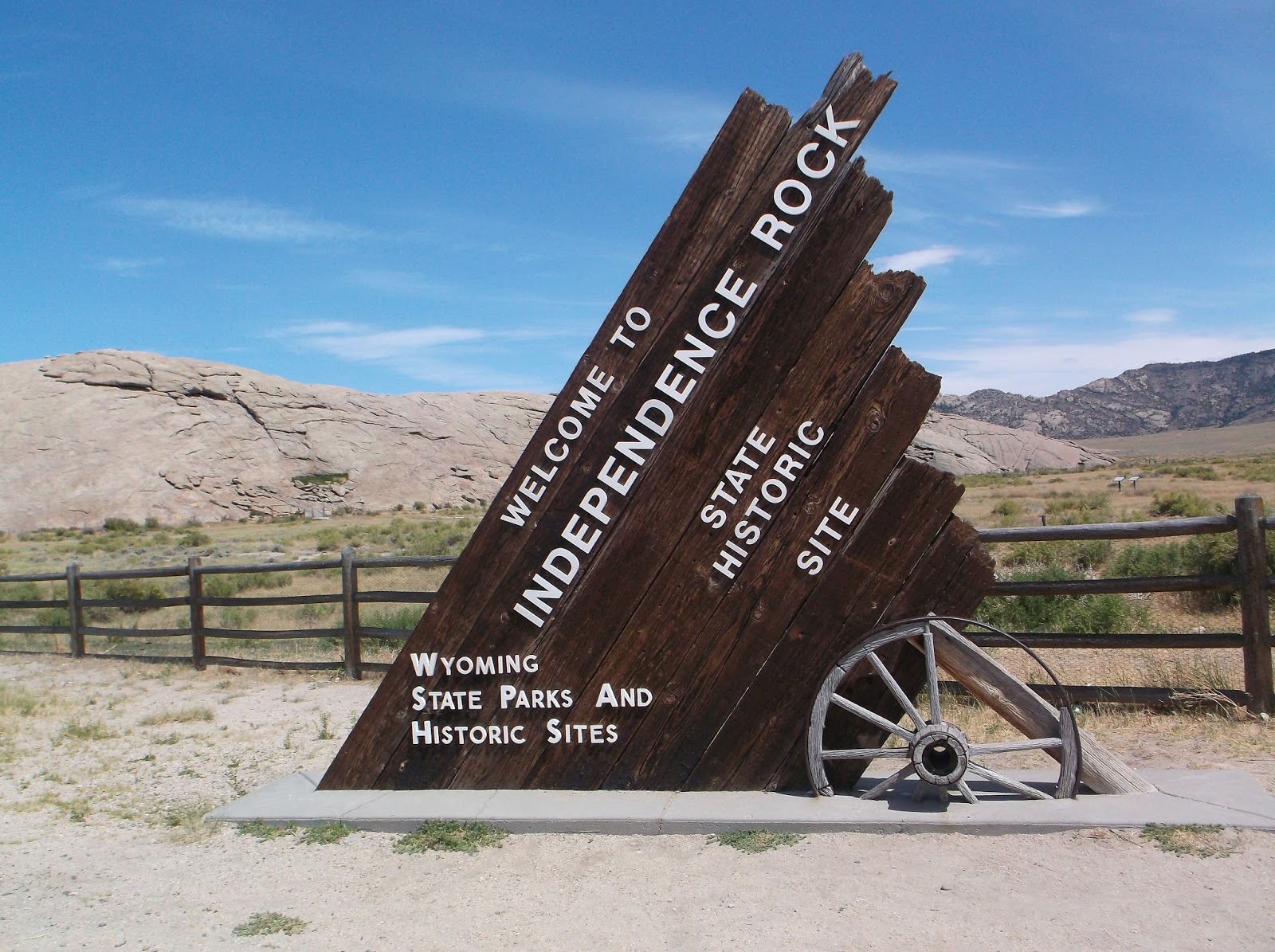
Independence Rock along the Old Oregon Trail
Historic Independence Rock marked the beginning of the 100-mile climb up the Sweetwater Valley to South Pass. Beyond South Pass 100 miles to the west where the trails branched off to Oregon, Utah, and California, some stretches of the trail were more than a single path across prairies and deserts. Some stretches of the trail were travel corridors more than a mile wide.
Imagine a travel corridor more than a mile wide!
State Historic Site
The Wyoming Highway Department has developed a Rest Area at the Independence Rock State Historic Site. It was a beautiful rest area to stop, picnic, and take time to learn more about this historic spot.
 |
| Independence Rock State Historic Site |
 |
| "Old Oregon Trail" embedded in stone walkway |
Independence Rock is an isolated mass of granite. It sprawls over 27 acres next to the meandering Sweetwater River. It is 700 feet wide, 1900 feet long, and more than a mile in circumference. It’s highest point above the rolling prairie stands 136 feet, as tall as a twelve-story building.
There was a walking bridge and sidewalk leading to the huge rock formation.
 |
| Walking bridge... |
 |
| ...and sidewalk leading to the huge rock formation |
Historians estimate that nearly 500,000 settlers, farmers, miners, businessmen and their families traveled through this valley from the early 1840s to 1869 on their way to Oregon, Utah, and California. Leading to a pass over the Continental Divide, the Sweetwater Valley was a natural travel corridor. Major waterways east of Independence Rock including the Platte and North Platte Rivers provided a clear route. After travelers left the North Platte River to follow the Sweetwater River to South Pass, Independence Rock was the first major landmark that travelers encountered.
Beneficiaries of Geological Events … over the course of time
 |
| Independence Rock |
Inscription on the sign:
“Thousands who traveled the Oregon Trail in central Wyoming were unaware they were the beneficiaries of a long series of geological events over the course of time. The granite peaks around you are mountains that rose, sank and then were buried in ashy sediments. Erosion exposed their summits and created the Sweetwater Valley, part of an east-west passageway through the Rockies. The route was used by game animals, Native Americans, and fur trappers, followed at mid-century by wagon trains and handcart emigrants, stagecoach passenger and Pony Express riders. For some this was the halfway point in a 2000-mile trek from the Missouri River to the West Coast. Arriving here in early July, emigrants celebrated Independence Day. In July, 1841, Jesuit missionary Pierre Jean De Smet wrote of this granite landmark: “The first rock which we saw, and which truly deserves the name, was the famous Independence Rock. It is of the same nature as the Rocky Mountains. At first I was led to believe it had received this pompous name from its isolated situation and the solidity of its base; but I was afterward told that it was called so because the first travelers who thought of giving it a name arrived at it on the very day when the people of the United States celebrate the anniversary of their emancipation from Great Britain…lest it might be said we passed this lofty monument of the desert with indifference, we cut our names on the south side of the rock under initials (I.H.S.), which we would wish to see engraved everywhere, and along with a great number of others, some of which perhaps ought not to be found anywhere. On account of all these names, and the dates that accompany them, as well as of the hieroglyphics of Indian Warriors, I called this rock on my first journey ‘The Great Record of the Desert’”.”
 |
| Some of the emigrants had no wagons, so they pushed "handcarts" similar to the one in the foreground. |
Signed in Stone…to Leave Evidence of their Passage
The largest concentration of historic inscriptions is located near the northwestern end of the rock. Signatures, however, have been found on numerous areas. Thousands of signatures were inscribed on the rock using chisels, axle grease, paint and tar. Most have worn away, leaving only the names engraved deep in hard granite.
Now faded away, one of the earliest signatures found was “M.K.Hugh, 1824”. Other early names include “Hanna Snow, 1844”, “G.Gingham, 1846”, “J.Bower, 1847”, “Milo Ayer, Age 29, 1849”, and “V.D.Moody, July 24, 1849”.
 |
| People could climb on the rock, but were asked not to walk on any signatures. |
The Fence at the Northwestern End of the rock
A fence prohibited access to the northwestern end of the rock.
 |
| The fence at the northwestern end of the rock. |
Behind the Fence
 |
| Inscriptions in the rock and the Masons marker |
Readable sir names in the photo above include Townsend, Wheeler, Banner, Mockler, Brooks, Wilson, Reed, etc.
Above the names inscribed in the rock is a Masons marker. The inscription on it reads:
“The first lodge of Masons in what is now the State of Wyoming, was convened on Independence Rock on July 4th, 1862, by a body of Master Masons who were traveling West on the Old Oregon Trail. To commemorate this event Casper Lodge No. 15, A.F. & A.M. of Casper, Wyoming, held memorial services here on July 4th, 1920.”
Whitman and Spalding Women Missionaries Marker
 |
| Whitman and Spalding Women Missionaries Marker |
Writing on the marker reads:
“Narcissa Prentiss Whitman and Eliza Hart Spalding, missionaries. First white women in Wyoming, and first women over Oregon Trail, 1836. Placard July 4, 1936, by The Historical Landmark Commission of Wyoming.”
Ezra Meeker (1830-1928)
Ezra Meeker was one of the 50,000 people who made up the 1852 emigration to the Oregon Territory. Besides being a successful hops farmer and a merchant, he was an influential advocate for preserving the Oregon Trail. He dedicated the end of the Oregon Trail in The Dalles, Oregon. From 1906 until his death, he retraced his 1852 Oregon Trail journey four times. He also met with President Teddy Roosevelt for the purpose of convincing him to assign priority to marking and protecting emigrant trails on federal lands. Most of his life he devoted to ensuring the emigrant trail was marked and preserved, and contributions of the overland pioneers would be honored by future generations. Read about the Ox-Team Monument Expedition below for more interesting information on the Ezra Meeker story.
The Ox-Team Monument Expedition
 |
| The Ox-Team Monument Expedition |
The writing on the monument reads as follows:
“In 1852 an estimated 50,000 pioneers passed Independence Rock on their way West. Among this number was the family of 21-year-old Ezra Meeker, recently of Eddyville, Iowa, but natives of Indiana. Meeker, his wife Eliza, and their infant son, arrived at Puget Sound, Washington Territory in October, 1852. They eventually settled in the Puyallup Valley, where over the years they experienced success and failure in farming, principally in raising hops.
“Keenly aware of the National significance of the Oregon Trail in the development of the American Pacific Northwest, Meeker wrote several books on the subject. In 1906, greatly concerned that the Oregon Trail would fade from memory, he decided to retrace the old trail eastward with covered wagon and ox team, for the purpose of permanently marking the trail. He called this journey the Ox-Team Monument Expedition.
“The presence of the 75-year-old pioneer with his long white beard, his considerable promotional skills, and the enthusiasm he engendered brought about a generous response from communities along the old trail. As a result, a line of stone monuments now marks the course of the trail from The Dalles, Oregon, across the mountains and plains to Kansas.
“Here at Independence Rock, he wrote:
“July 3, 1906, We drove over to the ‘Rock’, from the ‘Devil’s Gate’, a distance of six miles, and camped at 10:00 for the day…I selected a spot on the westward sloping face of the stone for the inscription, “Old Oregon Trail, 1843-57”, near the present traveled road, where people can see it…and inscribed it with as deep cut letters as we could make it with a dulled, cold, chisel, and painted, with sunken letters with the best of sign writer’s painting oil. On this expedition, where possible, I have in like manner inscribed a number of boulders, with paint only, which, it is to be hoped before the life of the paint has gone out, may find living hands to inscribe deep into the stone; but here on this huge boulder, I hope the inscription may last for centuries.
“Meeker continued his 1906 odyssey through major eastern cities to Washington, D.C., where on November 29, he met with President (Theodore) Roosevelt. In subsequent years, Meeker continued his promotion of the Oregon Trail. In 1916 he made the journey in a Pathfinder model automobile, and in 1924, he was flown over the trail by army pilots. The old pioneer died in Seattle, Washington, at the age of 97 on December 3, 1928.”
“Research and signing by the Oregon-California Trails Association, 524 South Osage Street, P.O.Box 1019, Independence, MO 64051. 2001. This is part of your American heritage. Honor it, protect it, preserve it for your children.”
National Historic Site
 |
| On the National Register of Historic Places |
Traveling On
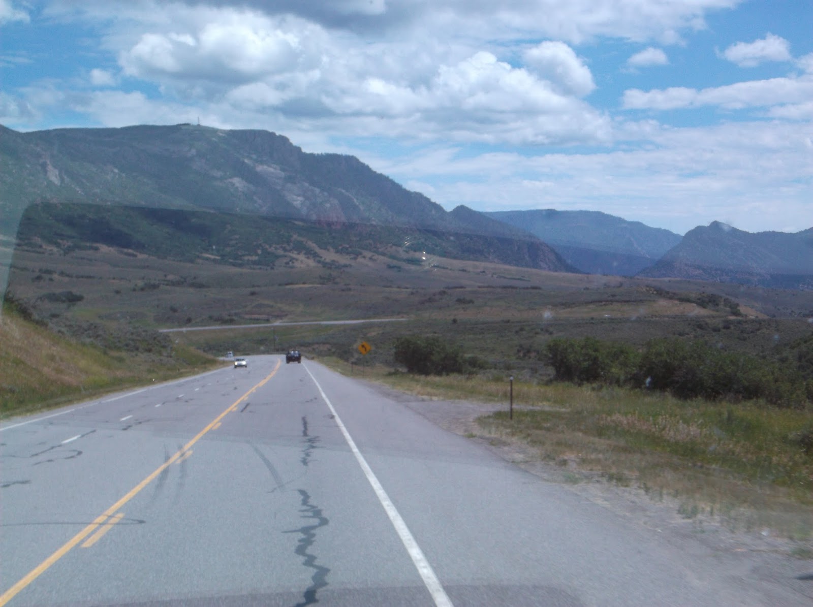
We followed 789, crossed the continental divide, and got some needed supplies at the Walmart at Rawlins, where we stayed for the night. On July 16, we left Rawlins on I-80, then continued south on 789 where we saw a lot of Natural Gas pumping stations (on the Baggs Road to Baggs, Wyoming).
 |
| One of the Natural Gas pumping stations we saw before leaving Wyoming |
Next post will be Colorful Colorado.
If you would like to be notified when that post publishes, put your email address in the appropriate box at the top right of this blog. Be sure to go to your email inbox and confirm your request, so you receive notification.
Thank you for following my blog. Feel free to make comments in the box below.
Also thank you for purchasing products through my links. Any clicks on my links are appreciated, as I may make a few pennies when a purchase is recorded after clicking a link on this blog, even when you purchase an item other than what you first clicked on.


